Interleaved Frequencies maps (old ones)
 Brian Butterworth published on UK Free TV
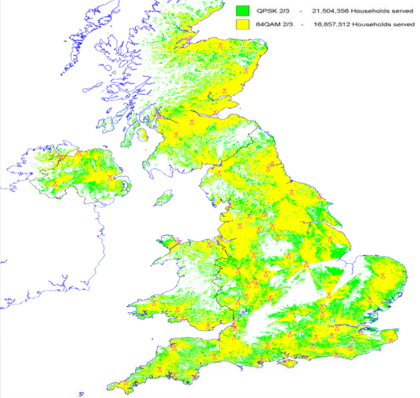
 These are the maps, supplied by Ofcom, showing the coverage areas for the "Interleaved Frequencies" than can be used for the Freeview Local TV service.
The green areas have good predicted coverage for the "Interleaved Frequencies", yellow is possible coverage.
Note: these areas are considerably different from the normal Freeview coverage for each transmitter.
Update: Ofcom introductory comments
The study considered frequency channels -5 below and +2 above the receive aerial
group for the station. Though for the 10 largest stations all channels were considered.
The ERP of main stations has been set at 10kW and relay stations at 1kW. It should
be noted that in several cases these powers result in a higher ERP than allocated to the
main multiplexes.
Coverage of the chosen channel has been assessed on the basis of the derived template
and the use of a 64QAM 2/3 modulation scheme. Availability of mast aperture, mast
loading and building space to support the required antennas and house transmitters
was not investigated.
Coverage calculations are based on existing broadcast stations and reception via fixed
roof top aerials.
The derived UK median templates are designed to protect populated coverage derived
by the median method. The derived UK continental templates include Irish and
Continental restrictions based on 23dB?V/m at the border.
The exercise has been based on version 5.51 of the UK digital plan and an
interpretation of the GE-06 frequency plan for Europe.
Coverage of each interleaved channel is quoted in isolation, i.e. only that channel and
the v5.5 plan have been considered.
As coverage is based on the template at the planned height and at the maximum ERP,
coverage using implemented antennas, heights and actual ERP will be lower.
Crystal Palace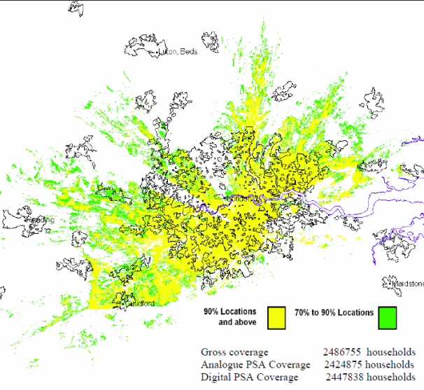
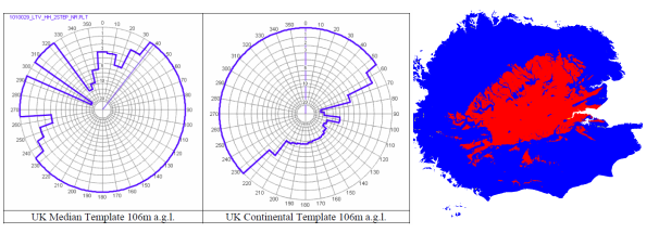
The Interleaved Map for the transmitter is created from three elements. The left circular image shows the UK post-switchover use of the same frequency, the central circular image is the Continental use of the same frequency. These are subtracted from the "normal" coverage area for the transmitter, the right hand image, to create the "Interleaved Frequency" coverage area.
Winter Hill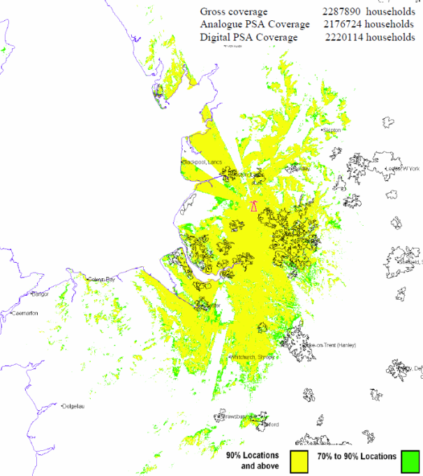
Black Hill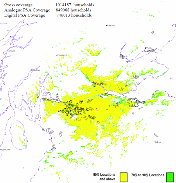
Sutton Coldfield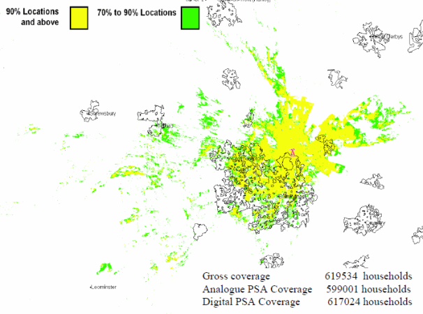
Pontop Pike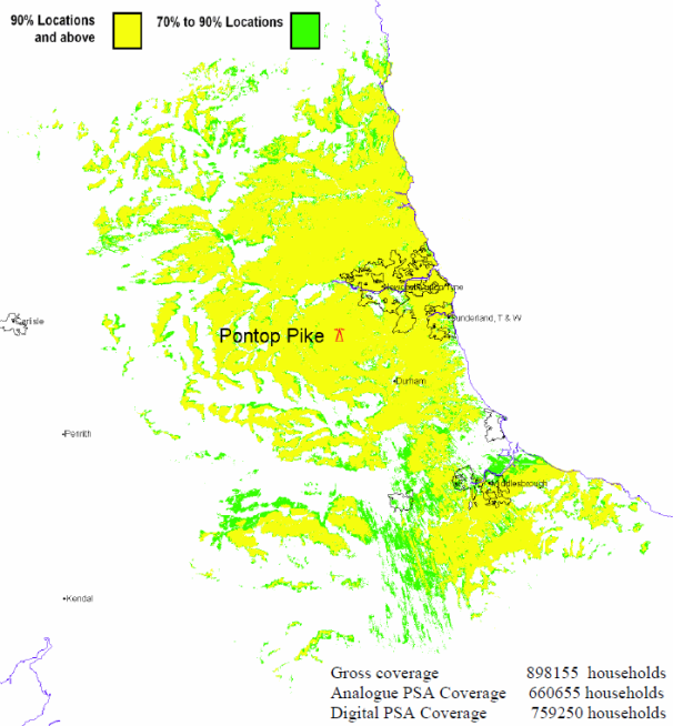
Emley Moor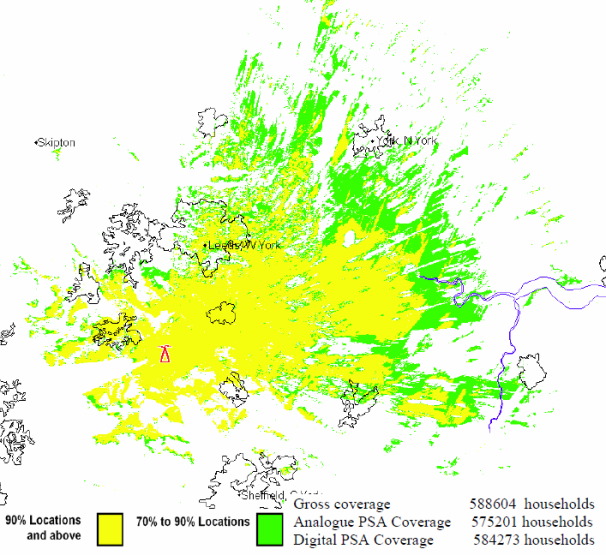
Bilsdale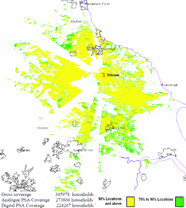
Rowridge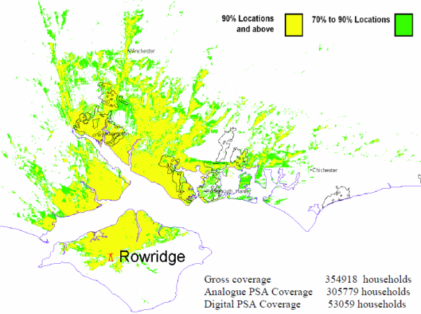
Waltham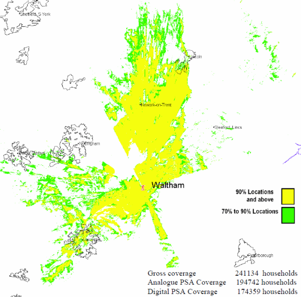
Craigkelly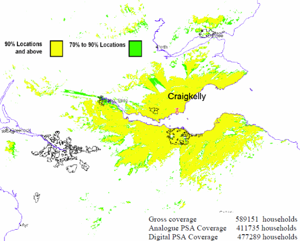
Wenvoe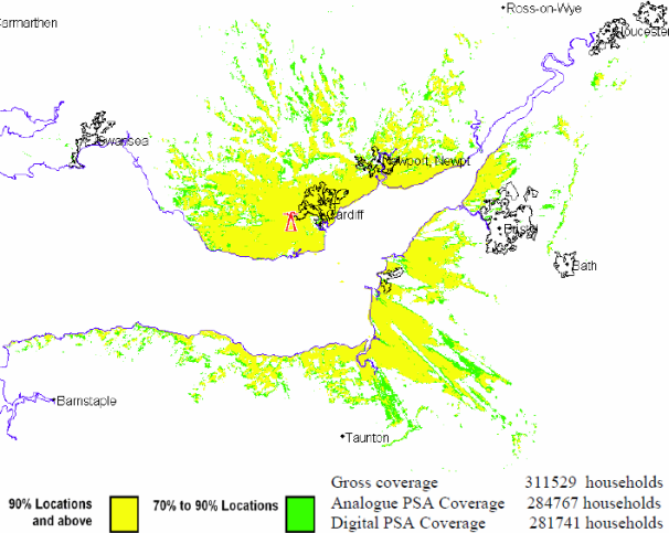
Belmont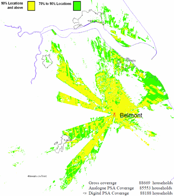
Hannington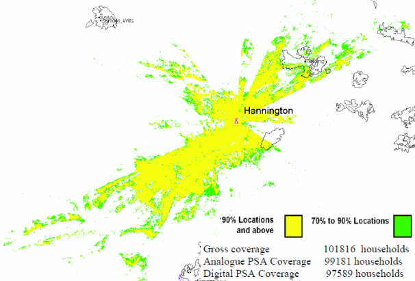
Divis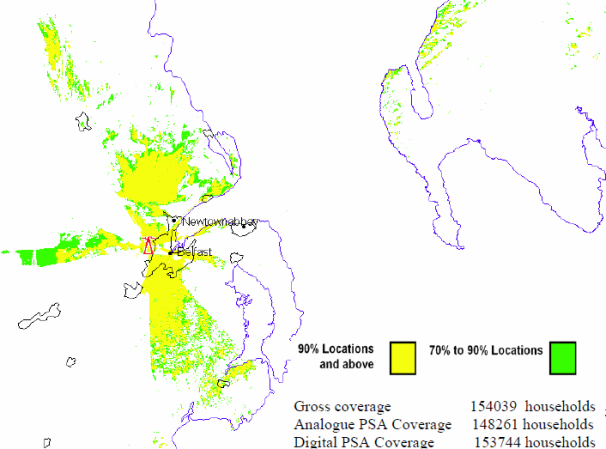
Tacolneston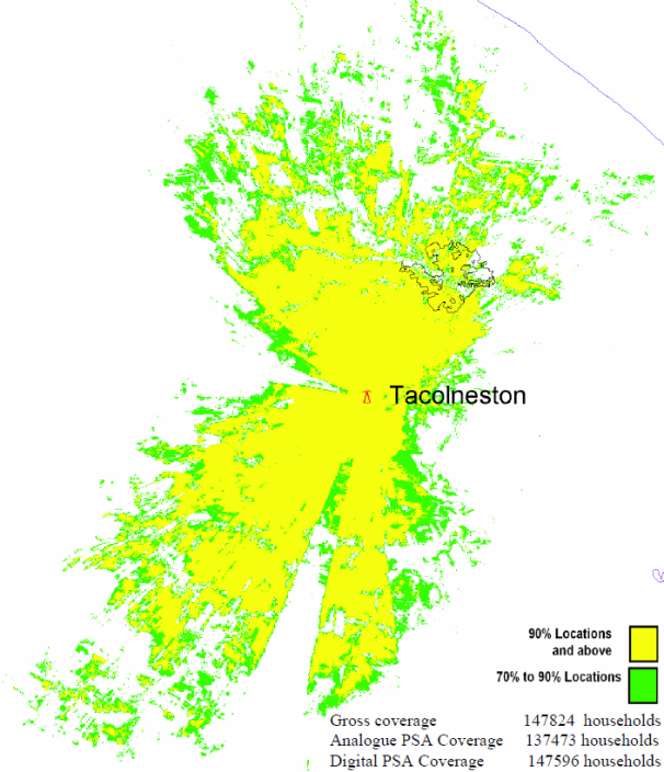
Sandy Heath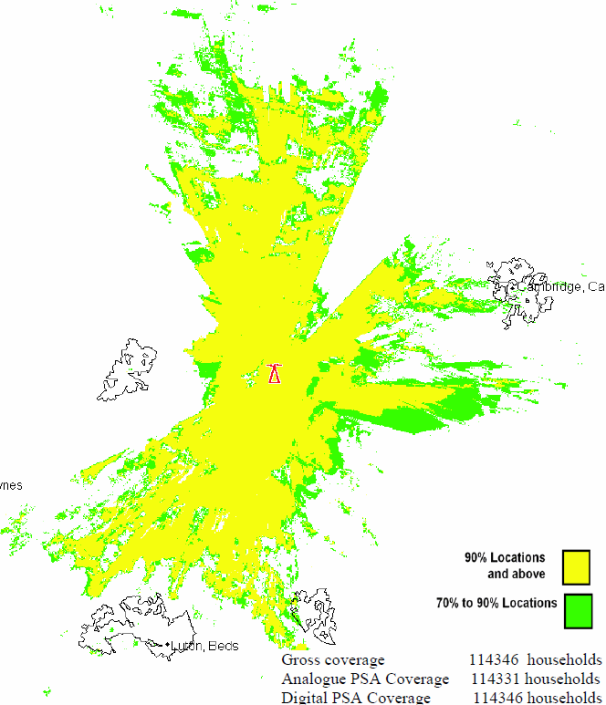
Mendip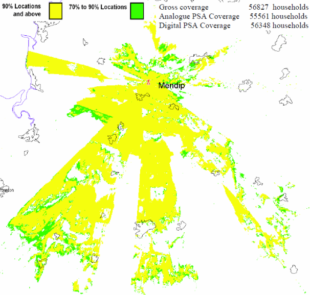
Sudbury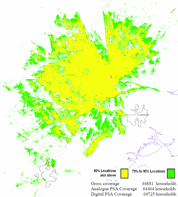
Oxford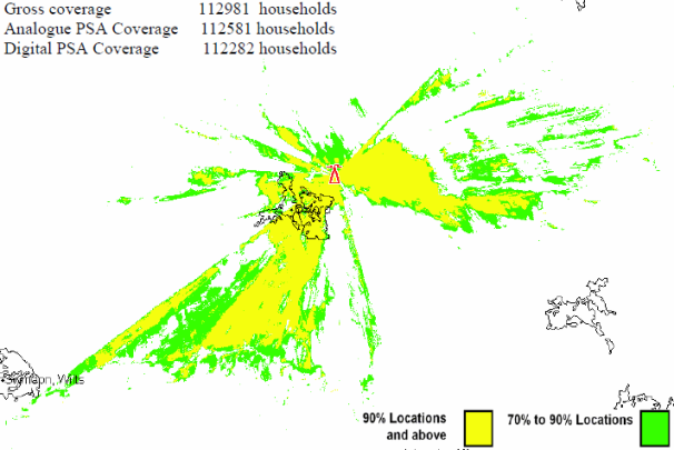
The Wrekin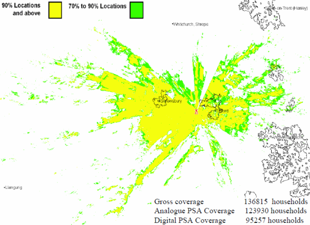
Dover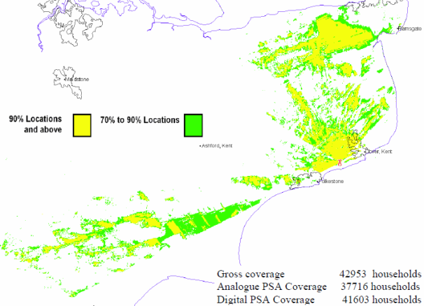
Ridge Hill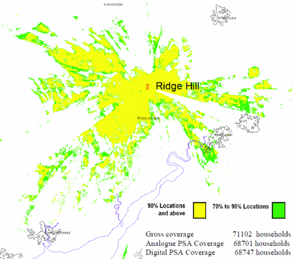
Caldbeck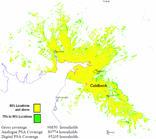
Durris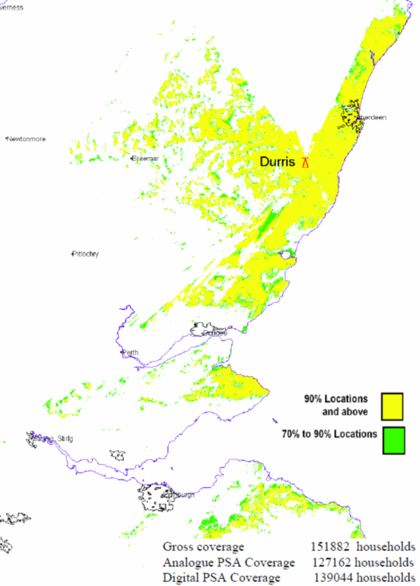
Angus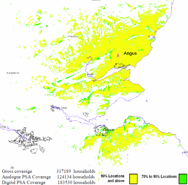
Limavady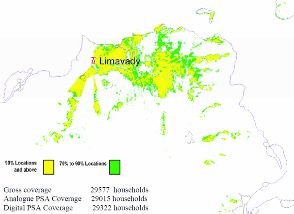
Knockmore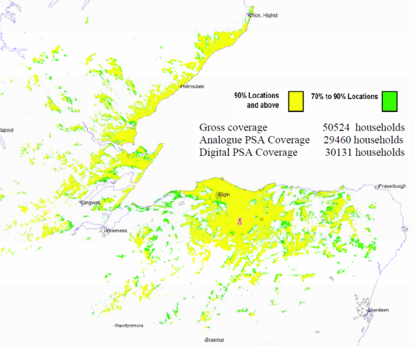
Rosemarkie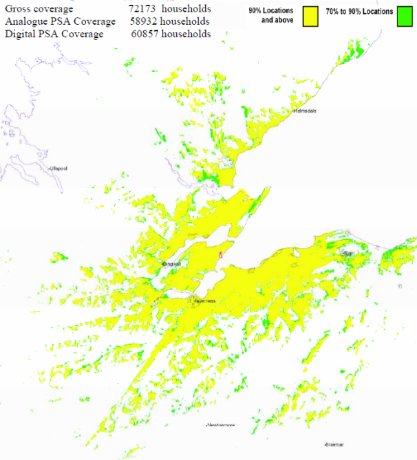
Hemel Hempstead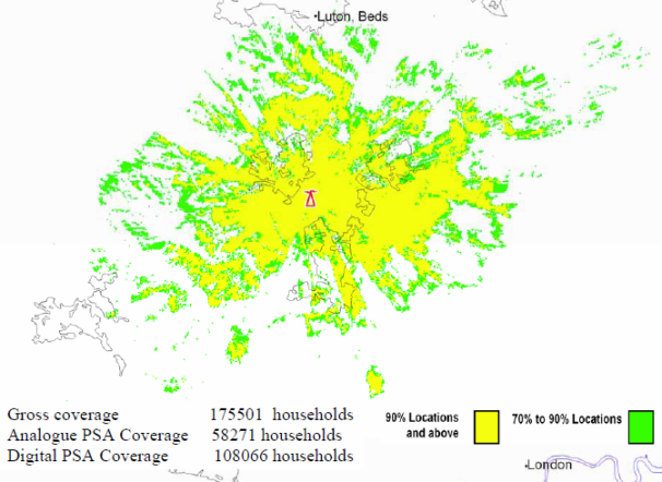
Brierley Hill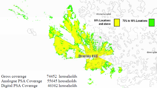
Bromsgrove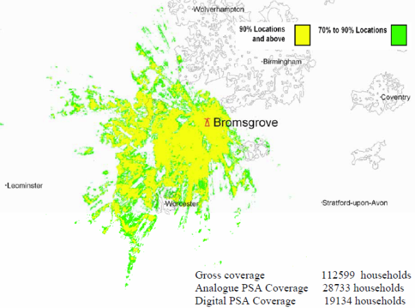
Kidderminster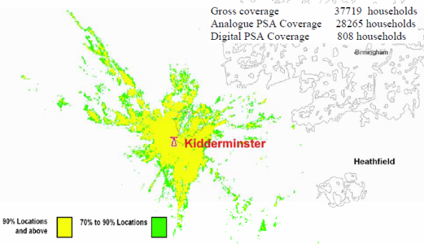
Storeton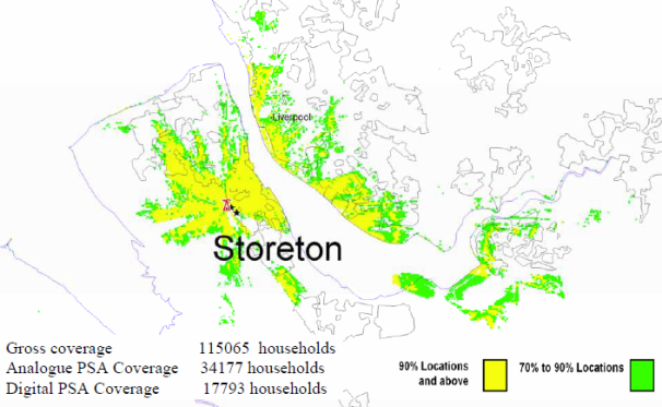
Sheffield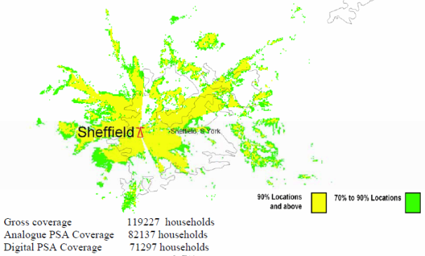
Guildford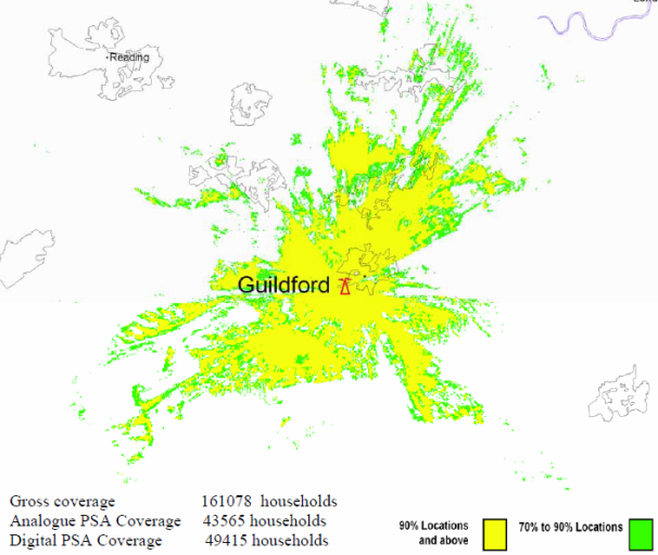
Reigate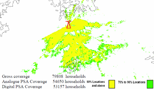
Tunbridge Wells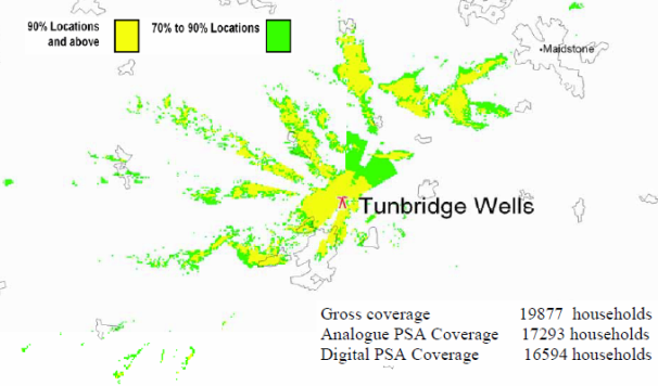
Malvern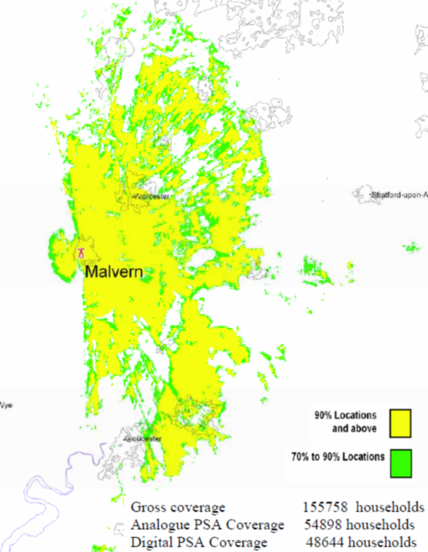
Lark Stoke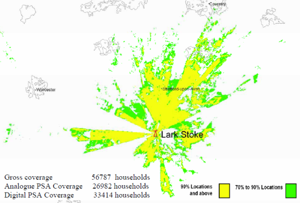
Fenton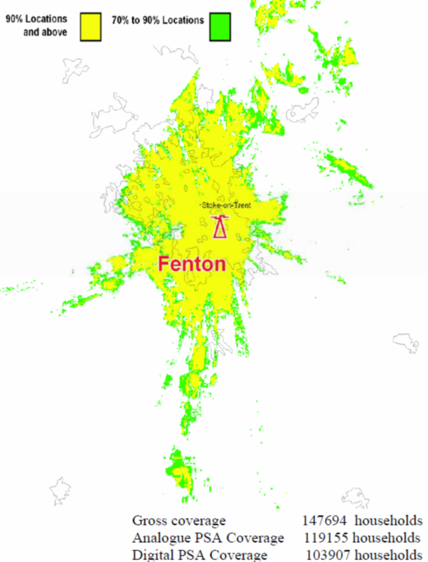
Pendle Forest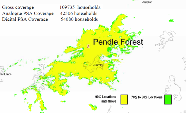
Saddleworth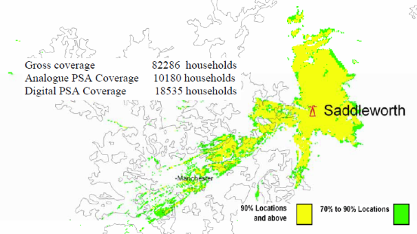
Lancaster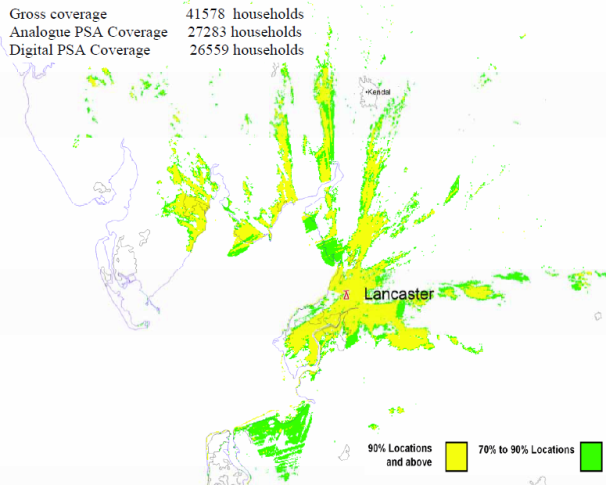
Keighley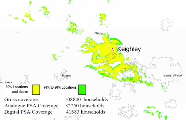
Kilvey Hill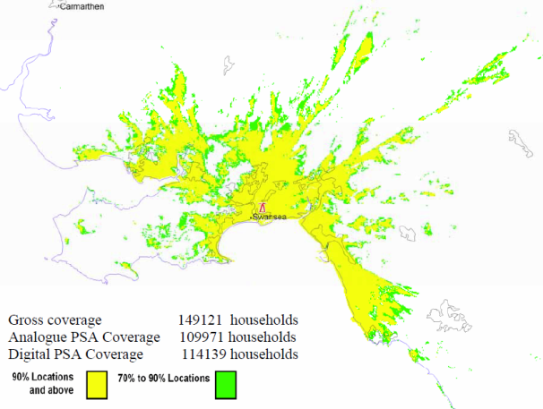
Salisbury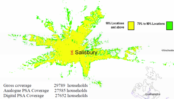
Poole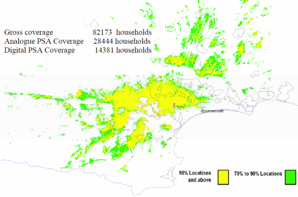
Whitehawk Hill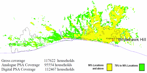
Fenham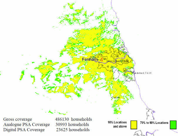
Bristol Kings Weston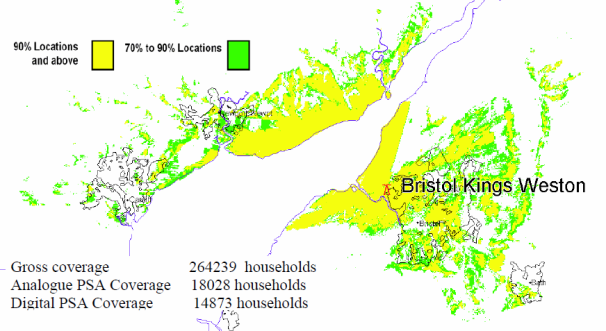
Bristol Ilchester Crescent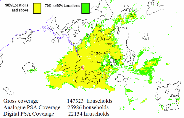
Nottingham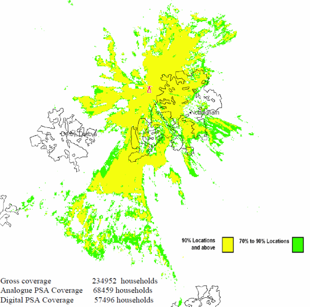
Llanddona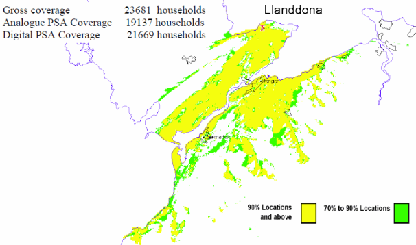
Carmel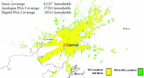
Olivers Mount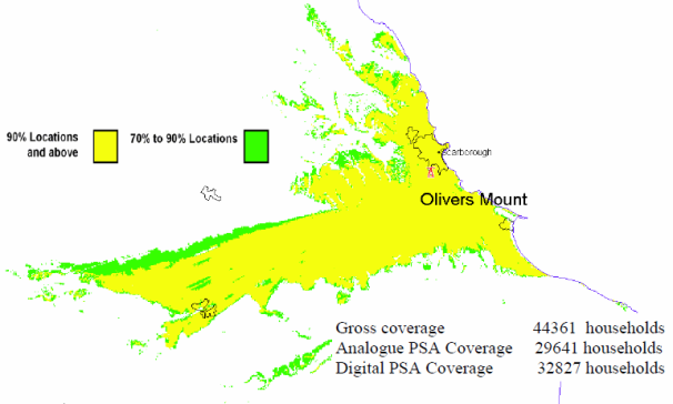
Luton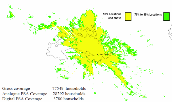
Midhurst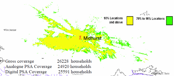
Preseli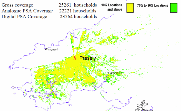
Caradon Hill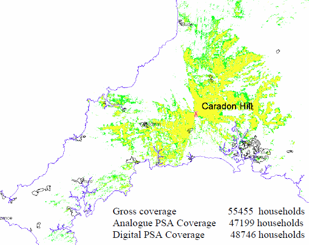
Plympton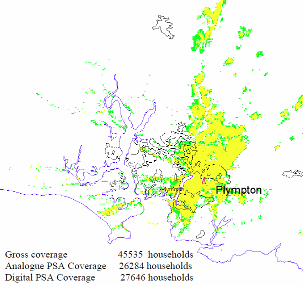
Stockland Hill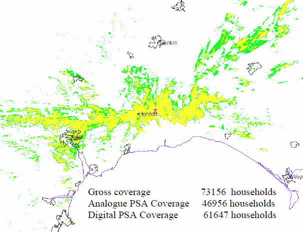
Beacon Hill![]()
Huntshaw Cross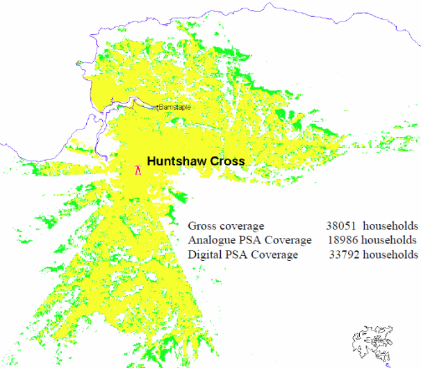
Redruth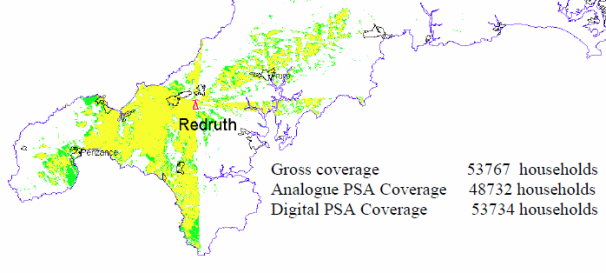
Moel Y Parc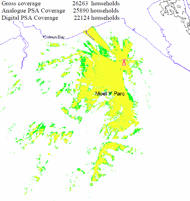
Brougher Mountain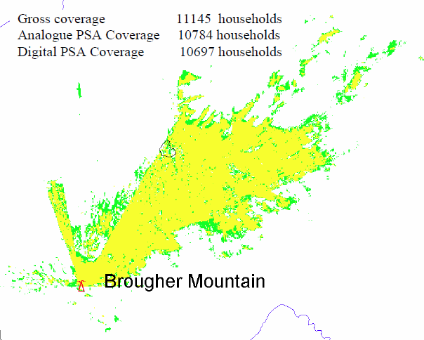
Darvel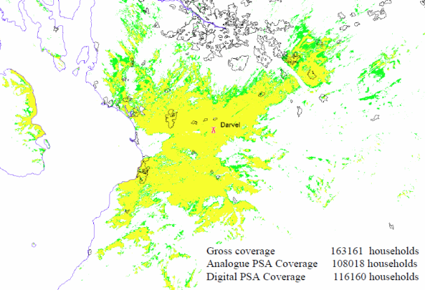
Rosneath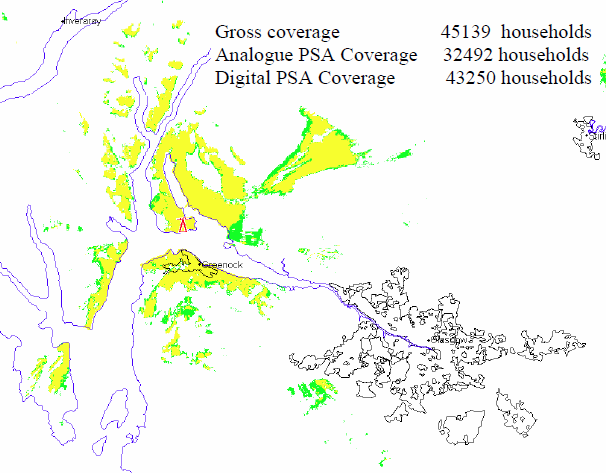
Bluebell Hill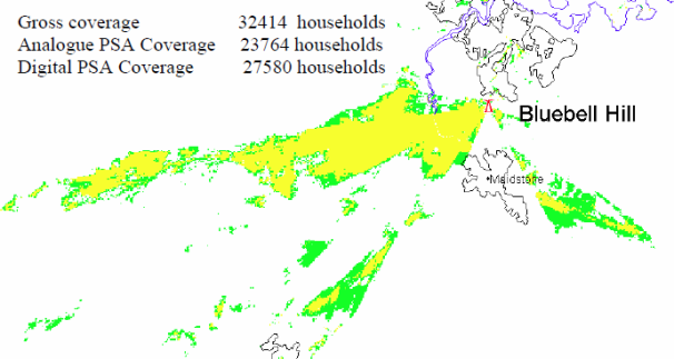
Londonderry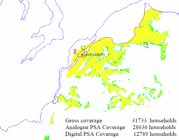
Heathfield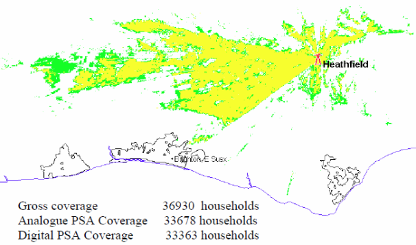
Selkirk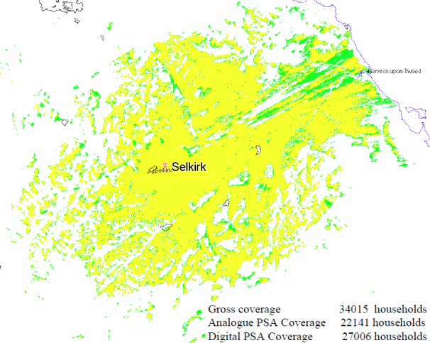
Bressay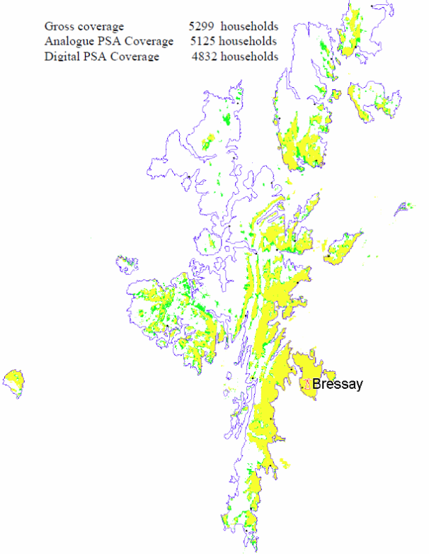
Torosay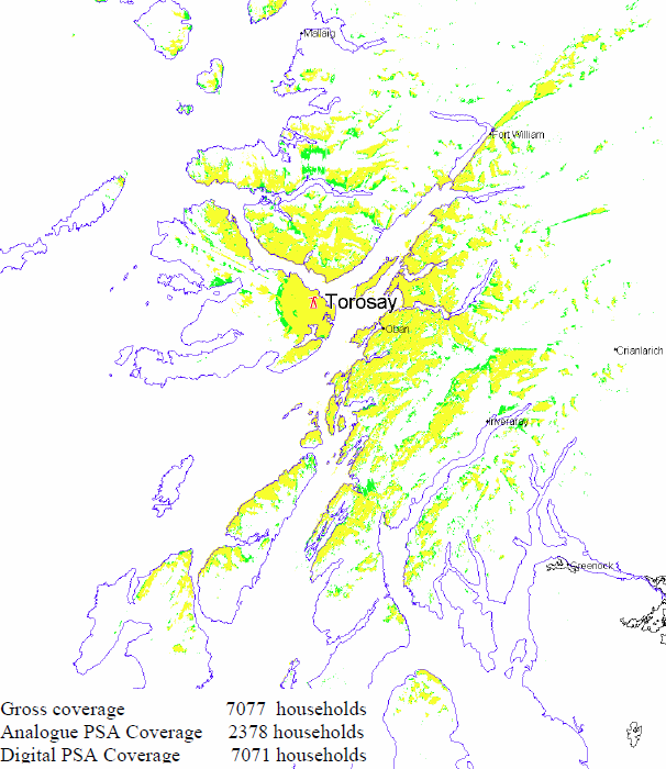
Perth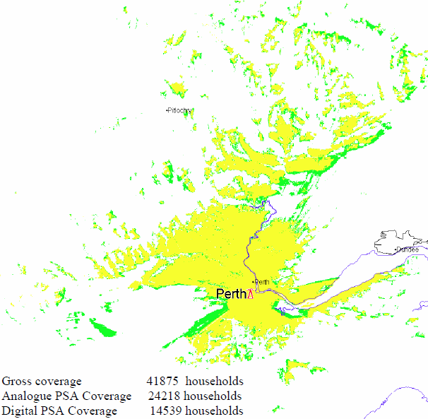
Tay Bridge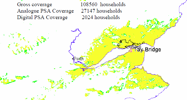
Keelylang Hill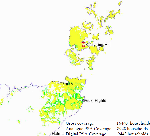
Rumster Forest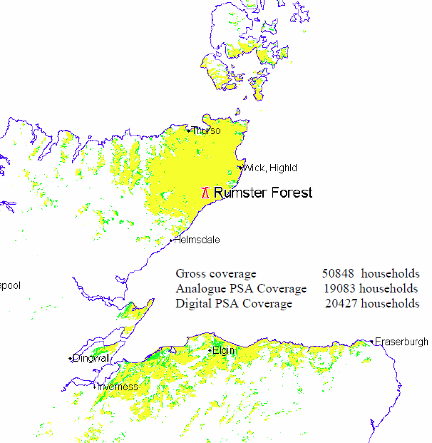
Eitshal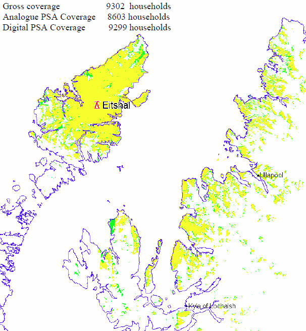
Balgownie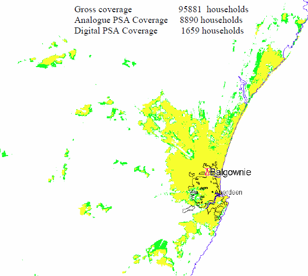
woodface: It's not the hill, these are Interleaved Frequencies so the restrictions are to prevent interference with UK and Continental transmitters using the same frequencies.
Do not confuse these with the normal multiplex radiation patterns.
| link to this comment |
Mike Dimmick: I wish that was the reason I missed it off the original list, but that was in fact an error.
As the Interleaved Frequencies are just the "sweepings up" after the allocations are complete, it is somewhat random which places get covered and which do not.
| link to this comment |
Ash: I've improved the introduction to assist with clarity.
| link to this comment |
6:07 PM
All is clear now I've read the interleaved frequencies explanation (at Local digital TV or a 7th multiplex coming soon? | ukfree.tv - independent free digital TV advice ).
It might be good to have OFCOM's national map of them reproduced big enough to appreciate. Perhaps on this page?
| link to this comment |
woodface: I've updated the map with a larger image - it is from Ofcom DDR Annexes page 183.
| link to this comment |
7:40 PM
Brigg
Brian-YOU'VE BEEN BUSY!,MAPS LOOK GOOD.
| link to this comment |
Des's: mapD's Freeview map terrainD's terrain plot wavesD's frequency data D's Freeview Detailed Coverage
Des Collier: Thanks. I am hoping this will lead to a sensible evaluation of the options for local TV.
| link to this comment |
12:01 AM
Looking at the map comparing QPSK and 64QAM, it strikes me as absolutely obvious that QPSK should be used. 21 million households versus 16 million is a no brainer in commercial terms. The one big problem is the lack of coverage in a line from The Wash to The Severn. Do you think that some extra frequencies, perhaps channels 35 and 37 could be used to fill this and other smaller holes? It would also be nice to provide some coverage for Mid Wales and Herefordshire.
| link to this comment |
Charles Stuart: Two points:
a) QPSK delivers lower bitrates, and hence less channel capacity.
b) These are interleaved frequencies, the whole point of which is NOT to use channels being sold off in the Digital Dividend sale.
| link to this comment |
12:13 PM
QPSK may allow for fewer channels but if the objective is meaningful local television, QPSK will be needed for these local channels to reach many significant population centres. My understanding is that an 8MHz PAL I TV channel can deliver three or four DVB-T channels using QPSK. As few areas would have the economic ability to support more than one or two local channels, I think that QPSK is the obvious choice. I guess that it depends where you put the priority and I'd definitely go for greater coverage with fewer channels.
I think that if two or three Digital Dividend channels were sacrificed to allow full local television coverage, that would be a good thing. That would still leave 12 or 13 channels to be sold off. Again, I guess it's about priorities and I'd like to see local television heading the list.
| link to this comment |