New! 1000s of new DAB and FM radio coverage maps

After 24 hours of eight CPUs chucking away at the data, I can now proudly announce that UK Free TV will now show you coverage maps for all of the UK radio and television transmitters.
In addition, the code has been cleaned up and now provides a consistent interface. You can now always single click to get the coverage and double-click to load up a page of details.
Digital (DAB) Radio
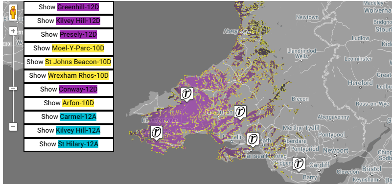
Here is an example from https://ukfree.tv/radio/digitalstations/BBC_Radio_Cymru

On a map of digital sites, you can click on the buttons at the top right to show a service/mast, or on the marker, or double-click the marker to get the full details. The different colours show the different broadcast "blocks" (transmission frequencies).
Analogue Radio
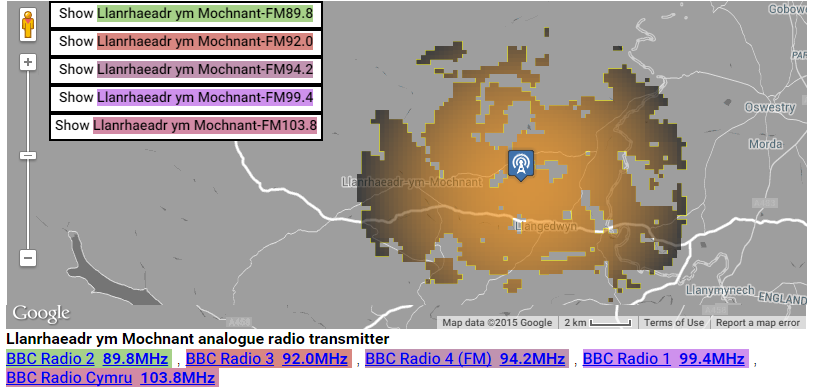
https://ukfree.tv/transmitters/analogueradio/Llanrhaeadr_ym_Mochnant

On this analogue map, you can use the buttons to select a frequency and site combination, or click to show a site, or double click for more details.
DAB Multiplex Maps
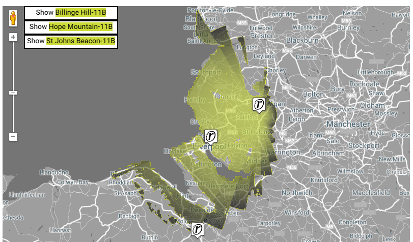
https://ukfree.tv/radio/multiplexes/11B/Liverpool

This is a multiplex map, so the colours are all the same.
Enjoy!
I really hope that you find these useful, and enjoy exploring the reception possibilities.
6:34 AM
Wow Brian!
I love it much better and more clearer... I want to say Well done chap! very impressed.
| link to this comment |
4:33 AM
Brilliant addition to the site. Very useful.
Thanks Brian
| link to this comment |
Phil/rob: Thanks. It is always good to hear that the work is useful and appreciated!
| link to this comment |
2:16 PM
Hinckley
I'm having trouble on understanding which pages I need to visit after putting my postcode in the settings.
| link to this comment |
Matt's: mapM's Freeview map terrainM's terrain plot wavesM's frequency data M's Freeview Detailed Coverage
3:12 PM
Briantist: Am I right in thinking that these will be right because effectively the radiation patterns are published by Ofcom in its tech parameters spreadsheet? (These being attenuation figures every 10 degrees.)
| link to this comment |
9:25 PM
Bourne End
Thanks for your improvement work. I just tried a postcode which showed the wrong transmitter feeding the area. Please look to amend the transmitter for SL8 5DQ. It's not High Wycombe but it should list the Wooburn Transmitter (which is also closer). Your map of the Wooburn coverage area as shown here: Wooburn (Buckinghamshire, England) Freeview Light transmitter includes this postcode area so I'm not sure what's gone wrong. Both are relays of Crystal Palace though. I hope that helps.
| link to this comment |
Paul's: mapP's Freeview map terrainP's terrain plot wavesP's frequency data P's Freeview Detailed Coverage
Dave Lindsay: yes, that is correct. All the FM and DAB plots are direct from the Ofcom spreadsheet
I have also added new code to do the AM areas too.
| link to this comment |
Paul Murphy: Thanks for your post.I've had a good look and it seem to be at one of those knife-edge positions.Sometimes this happens when the postcode (all of it) resolves to a large area. In a city, a postcode can sometimes refer to just one building, or just a few. In rural areas the postcode can be quite a physically large area.You are right, if you use the GPS option on your phone you would get the "right" answer, but the postcode isn't accurate enough.
| link to this comment |
I love the new maps, but they're not updating?
Lincs FM has gone on air on the LincsMux and Yorks MUX gone, but the maps aren't updated to show the new coverage area?
Thanks
| link to this comment |
Peter Wright: Thanks... The coverage maps are generated by a separate system that I will need to run and then upload... I will sort this as soon as I can.
| link to this comment |
